The GIS Software and spatial data gathering and processing is getting more and more popular these days all over the world and the ability having quick, fast and reliable workflow is becoming very important. Mapit Pro has become a day to day tool for thousands of people across the world and we are hoping that Mapit Spatial is going to improve and make your workflow even more efficient and cost-effective solution.
Mapit GIS Professional is the latest product from Mapit GIS Ltd. fully compatible with Android 11+ requirements in terms of compatibility with Google Play.


Target Audience
We would like to address our application to everyone who is working with spatial data and is responsible for any kind of location related tasks. There is number of science and business-related areas relying or depending on the accurate information coming from Geographic Information Systems and we do hope Mapit Spatial is going to become your day to day tool when you are making things right out there in the field.
Particularly the app is dedicated to people who are working in agriculture, forestry, housing development or land survey industry, but also to customers responsible for design work in power industry, water supply and sewage systems, gas industry, telecommunication and road engineering. Mapit Professional can be also adopted for any kind of spatial asset management tasks, fishery and hunting, habitat and soil mapping or to whatever needs you can think off, but of which the authors of the application have never thought.
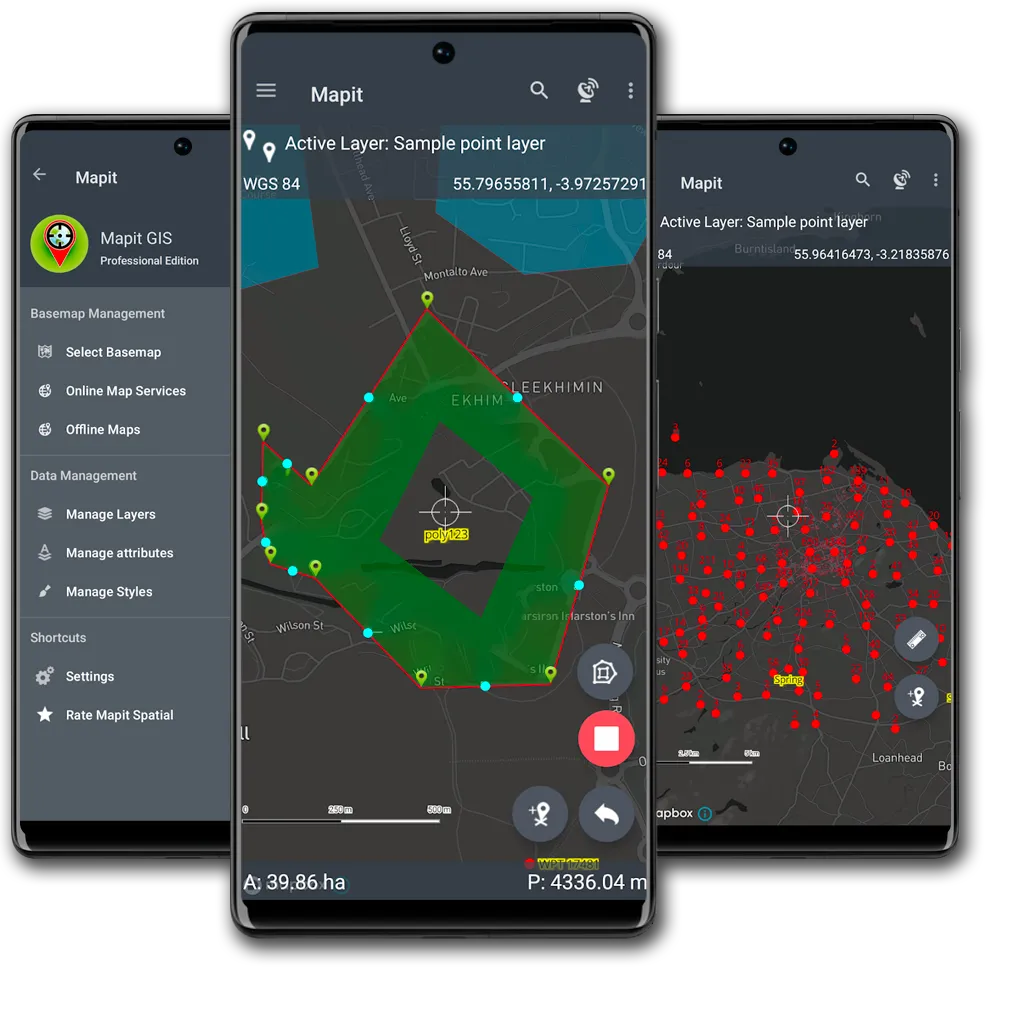
Main functionality changes
Mapit GIS Proffessional uses Mapbox Maps SDK instead of Google Maps used in the previous versions of the app. The database engine is also upgraded and now is deployed as a Geopackage format compatible with the OGC standard, allowing one-click ecport of all mapit data as geopackage file (*.gpkg) and immediate access to geospatial information collected in the field from desktop software like qGIS.
Core functionality
- a collection of spatial data in the form of POINT, LINE or POLYGON datasets,
- calculation of areas, perimeters and distances.
- management of the data in the form of geopackage projects
- survey design
- data sharing